
Headline
Pokémon Go Data Powers AI to Help Robots Deliver Pizza on Time
Key Facts
- Niantic Spatial, spun out from Pokémon Go developer Niantic in May 2025, is using crowdsourced images from hundreds of millions of players to build a visual positioning system.
- The system achieves location accuracy within a few centimeters using images of urban landmarks, addressing GPS failures in dense city environments.
- Niantic Spatial has trained its model on 30 billion images captured in urban settings, focused on high-traffic game locations.
- The technology is now being deployed with Coco Robotics, which operates about 1,000 sidewalk delivery robots making pizza and grocery deliveries in cities including Los Angeles, Chicago, Miami, Jersey City, and Helsinki.
- Coco Robotics robots have completed more than 500,000 deliveries, but GPS unreliability in “urban canyons” has been a major obstacle to on-time performance.
Lead paragraph
Niantic Spatial is repurposing the vast trove of location-tagged images collected from Pokémon Go and Ingress players to create a visual positioning AI that helps delivery robots navigate accurately where GPS fails. The company, spun out from Niantic last year, has partnered with Coco Robotics to improve the reliability of its sidewalk robots that deliver pizzas and groceries in multiple U.S. and European cities. By training on 30 billion crowdsourced images, the system can pinpoint a robot’s location to within centimeters using only a few snapshots of surrounding buildings, addressing a long-standing challenge for autonomous last-mile delivery.
Body
Pokémon Go, released in 2016 by Niantic, became one of the most successful augmented-reality applications ever, with 500 million installs in its first 60 days. Even in 2024, the game attracted more than 100 million monthly players, according to Scopely, which acquired the title from Niantic. Every time players pointed their phones at buildings to catch virtual creatures, they generated precisely tagged images of real-world locations. Niantic Spatial, established in May 2025, is now transforming that data into what the industry calls a “world model” — a geospatial foundation intended to anchor AI systems in physical reality.
The core technology is a visual positioning system. Rather than relying on satellite signals, it determines location by analyzing what a camera sees. Brian McClendon, CTO at Niantic Spatial, explained that the company has data from more than a million high-precision locations worldwide where players congregated for gameplay. At each of these spots, thousands of images were captured from different angles, times of day, and weather conditions, all accompanied by rich metadata including exact position, orientation, movement speed, and direction.
This dataset enabled Niantic Spatial to train a model on 30 billion urban images. The resulting system can take a handful of snapshots of landmarks and determine the observer’s position to within a few centimeters. John Hanke, CEO of Niantic Spatial, noted the surprising convergence of technologies: “It turns out that getting Pikachu to realistically run around and getting Coco’s robot to safely and accurately move through the world is actually the same problem.”
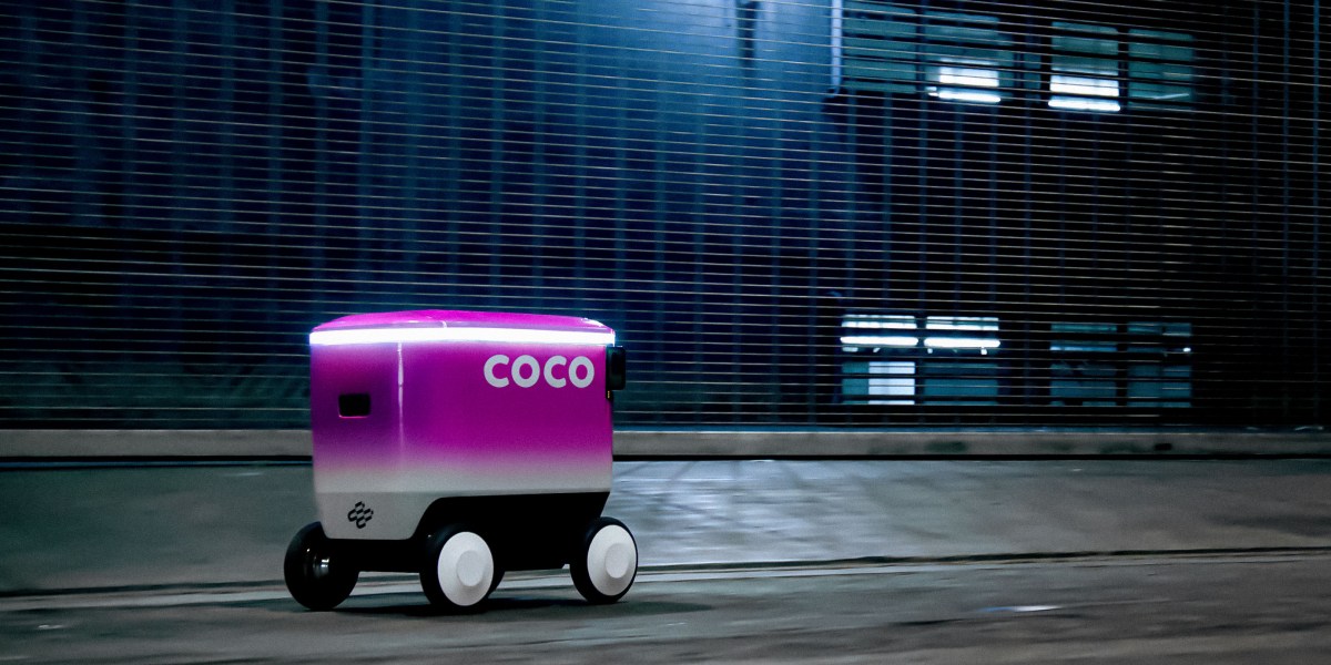
Coco Robotics operates roughly 1,000 delivery robots across Los Angeles, Chicago, Jersey City, Miami, and Helsinki. The robots, roughly the size of large suitcases, travel sidewalks at about five miles per hour and can carry up to eight extra-large pizzas or four grocery bags. CEO Zach Rash said the company has completed more than half a million deliveries covering millions of miles. On-time arrival is critical for customer satisfaction and for competing with human couriers.
GPS performs poorly in dense urban areas. Radio signals bounce off high-rise buildings, creating “urban canyons” where positioning can drift by 50 meters or more, often placing a robot on the wrong block or side of the street. “We do deliveries in a lot of dense areas with high-rises and underpasses and freeways, and those are the areas where GPS just never really works,” Rash said. Niantic Spatial’s visual system is designed to solve exactly this problem by matching live camera imagery against its massive, precisely labeled database.
Konrad Wenzel at geospatial software firm ESRI observed that visual positioning is not new technology, but the scale of data now available dramatically improves its performance. “It’s obvious that the more cameras we have out there, the better it becomes,” he said. Niantic’s advantage lies in the sheer volume and quality of its crowdsourced data, collected over nearly a decade from players actively seeking out specific real-world locations.
Impact section
For developers and robotics companies, the partnership represents a practical demonstration of how large geospatial models (LGMs) can ground AI in the physical world. Delivery robots are among the most immediate commercial applications for such technology, but the same visual positioning capabilities could extend to autonomous vehicles, drones, AR glasses, and mapping services.
The story also highlights ongoing discussion about the use of player data. Multiple reports note that Pokémon Go users have been unwittingly contributing to the training of these AI models for years. While Niantic has long collected location and image data for game functionality, the pivot toward training commercial AI systems for robotics has drawn attention from players and privacy observers. Niantic Spatial maintains that the data was gathered with user consent through the games’ terms of service.
For the robotics industry, centimeter-level accuracy in GPS-denied environments could significantly increase reliability and expand the areas where sidewalk robots can operate. Reliable navigation directly translates into better customer experience and higher utilization rates for companies like Coco Robotics.
What's next
Niantic Spatial plans to continue expanding its world model using additional data from its games and potentially new sources. The company has indicated that visual positioning is just the beginning of a broader effort to build comprehensive geospatial AI that can support multiple device types beyond delivery robots.
Coco Robotics intends to roll out the Niantic Spatial technology more widely across its fleet to improve on-time delivery performance in challenging urban environments. The companies have not disclosed exact timelines for full deployment or whether the partnership will expand to additional cities.
The success of this initial test could accelerate adoption of large geospatial models across the robotics and autonomous systems sectors. As more companies seek solutions for reliable navigation without constant GPS availability, crowdsourced visual datasets like Niantic’s may become increasingly valuable assets.
Sources
- How Pokémon Go is helping robots deliver pizza on time
- Gotta Catch 'Em All: How Pokémon Go covertly captured your data for years to train a massive AI model
- Your Pokémon Go data is being used to train AI
- Pokemon Go developer Niantic is using player data to train AI that could power map-roaming robots